MapStore
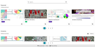
Anyone with a browser can open the maps, dashboards, and scrolling stories that a team builds in MapStore from its geospatial data. Layers come from WMS, WFS, WMTS, CSW, and TMS catalogs or from imported shapefiles, KML, GeoJSON, and GPX files, then sit in a layer tree with groups, opacity, filters, styles, and attribute tables. Charts, counters, tables, and text widgets pin to a map or join a dashboard, where a filter on one table updates every connected widget. A story editor combines title, paragraph, immersive, media, and GeoCarousel sections, so maps, photos, and video unfold as the reader scrolls. A 3D mode tilts any map into a globe, where map views play in sequence and a translucent globe reveals underground layers. Measurement tools report distance, area, and bearing, and annotations place markers, lines, polygons, text, and circles. Maps print to PDF, PNG, or JPEG with legends on A3 or A4 sheets, and a timeline animates GeoServer layers that have a time dimension. Resources are shared by link or QR code, and maps add permalinks and embed code. Administrators manage users and groups, and each resource can grant read or write access to chosen groups. Custom application contexts let a team choose the starting map, the enabled plugins, and the theme of its own viewer. Running on a dedicated VPS on RepoCloud with guaranteed CPU, RAM, and SSD, full root SSH access, and a browser serial console. BSD-2-Clause licensed.
NextGIS Web
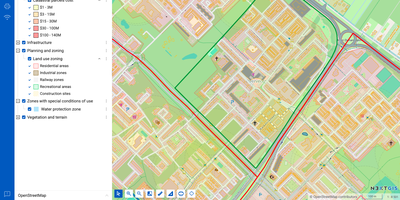
NextGIS Web turns shapefiles, GeoTIFFs, and QGIS projects into shareable web maps on your own server, with no per-seat GIS license to buy. Upload ESRI Shapefile, GeoJSON, GeoPackage, KML, CSV, or GeoTIFF files, or connect an external PostGIS database, then style layers with QGIS styles so web maps match the desktop project. Visitors can search, filter, measure, print, and embed maps on other sites, while editors draw or move points, lines, and polygons, type in coordinates, and snap to existing geometry without leaving the browser. Vector layers keep a history of who changed what and when, so a bad edit can be rolled back and a snapshot of the data at a chosen point in time can be recovered. Layers can be published as WMS, WMTS, WFS, OGC API Features, raster tiles, vector tiles, or Cloud Optimized GeoTIFF, and third-party TMS, WMS, and WFS services can be pulled into the same maps. With the NextGIS Connect plugin, QGIS users publish projects and edit server data directly, so a whole team works on one shared dataset. Permissions are granted to users and groups down to a single layer or map, and Galleries collect the key maps into one landing page. A REST API covers users, layers, services, maps, and permissions, and JavaScript libraries help developers build custom map applications. Running on a dedicated VPS on RepoCloud with guaranteed CPU, RAM, and SSD, full root SSH access, and a browser serial console. GPL-3.0 licensed.