GeoNode
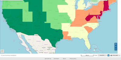
GeoNode turns a pile of shapefiles, GeoTIFFs, and spreadsheets into a searchable catalog of datasets, interactive maps, stories, and dashboards that your organization, or the whole world, can browse. Vector data in Shapefile, GeoJSON, CSV, KML, and KMZ formats and GeoTIFF rasters arrive through a web form, and a styler previews symbology changes in real time. Every resource carries consistent metadata that follows ISO 19115 and ISO 19139, key fields can be filled by importing ISO, FGDC, or Dublin Core XML, and published datasets are available through WMS, WFS, WCS, WMTS, and a CSW catalogue so any GIS client can connect. Maps combine local datasets with remote WMS layers over base maps such as OpenStreetMap, and saved maps can be embedded in any web page or printed to PDF. GeoStories weave text, maps, images, and video into narratives, while dashboards connect charts, counters, tables, and maps as linked widgets. Vector datasets can be exported as Zipped Shapefile, CSV, Excel, GeoJSON, or KML, and harvesters keep resources synchronized with other GeoNode sites, WMS servers, and ArcGIS REST services. Each resource can stay public or be limited to chosen users and groups, with profiles, comments, and ratings for the community, and a REST API plus an admin panel cover integration and user management. Running on a dedicated VPS on RepoCloud with guaranteed CPU, RAM, and SSD, full root SSH access, and a browser serial console. GPL-3.0-or-later licensed.
NextGIS Web
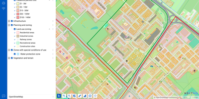
NextGIS Web turns shapefiles, GeoTIFFs, and QGIS projects into shareable web maps on your own server, with no per-seat GIS license to buy. Upload ESRI Shapefile, GeoJSON, GeoPackage, KML, CSV, or GeoTIFF files, or connect an external PostGIS database, then style layers with QGIS styles so web maps match the desktop project. Visitors can search, filter, measure, print, and embed maps on other sites, while editors draw or move points, lines, and polygons, type in coordinates, and snap to existing geometry without leaving the browser. Vector layers keep a history of who changed what and when, so a bad edit can be rolled back and a snapshot of the data at a chosen point in time can be recovered. Layers can be published as WMS, WMTS, WFS, OGC API Features, raster tiles, vector tiles, or Cloud Optimized GeoTIFF, and third-party TMS, WMS, and WFS services can be pulled into the same maps. With the NextGIS Connect plugin, QGIS users publish projects and edit server data directly, so a whole team works on one shared dataset. Permissions are granted to users and groups down to a single layer or map, and Galleries collect the key maps into one landing page. A REST API covers users, layers, services, maps, and permissions, and JavaScript libraries help developers build custom map applications. Running on a dedicated VPS on RepoCloud with guaranteed CPU, RAM, and SSD, full root SSH access, and a browser serial console. GPL-3.0 licensed.