Reitti
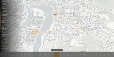
Reitti turns raw GPS coordinates from your phone and fitness trackers into an interactive daily timeline and private map that replaces Google Timeline and Life360 without sending your movement history to third-party clouds. Every coordinate you record is analyzed automatically to detect stationary visits, recognize significant places, and classify trips between walking, cycling, and driving with exact duration and distance metrics. Stream real-time updates from OwnTracks, GPSLogger, Overland, or Home Assistant, or upload historical archives from GPX files, GeoJSON, Google Takeout, and Google Timeline exports. Switching between a smartphone and a dedicated cycling computer never fragments your history. The visual workbench lets you stitch multi-device recordings across any time range, drag misplaced GPS points into position on the map, and delete signal outliers with a single click. Connect a self-hosted Immich server so geotagged photos appear directly alongside the routes and stops where you captured them. Turn memorable trips into narrative travel logs with customizable text, map, and photo blocks. Need to coordinate a meetup or share your arrival time? Share live positions with family members on the same server, federate across trusted instances, or send revocable magic links to friends without accounts. Customize your view with custom vector styles from MapTiler or Stadia Maps and explore movement statistics across top destinations. Running on a dedicated VPS on RepoCloud with guaranteed CPU, RAM, and SSD, full root SSH access, and a browser serial console. AGPL-3.0 licensed.
Dawarich
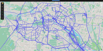
With over 9,000 GitHub stars earned since Google killed its browser-based Timeline, Dawarich fills the gap with a fully self-hosted location history platform that keeps your movement data under your control. Built on Ruby on Rails 8.0 with PostgreSQL and the PostGIS spatial extension for geometry-based queries, Dawarich imports your entire Google Takeout location archive in minutes and begins rendering interactive maps immediately. The visualization engine supports five map layers — heatmaps, points, lines, Fog of War exploration tracking, and a 3D globe view — each powered by Leaflet and spatial SQL rather than browser-side computation. Native iOS and Android apps handle background GPS tracking with offline support, automatically uploading location points when connectivity returns, while third-party integrations support OwnTracks, GPSLogger, Overland, Home Assistant, Traccar, and PhoneTrack. The trip system lets you create route visualizations between any two dates, attach notes, replay travel paths with a timeline scrubber, and share trips publicly with phrase-protected links and per-section visibility controls. Immich and PhotoPrism integrations automatically overlay geotagged photos on your maps and trips, while AirTrail integration renders flight history as arcs. Statistics dashboards break down countries visited, cities explored, total distance traveled, and active days by year and month, with visit detection suggesting places you have frequented. Running on a dedicated VPS on RepoCloud with guaranteed CPU, RAM, and SSD, full root SSH access, and a browser serial console. AGPL-3.0 licensed.